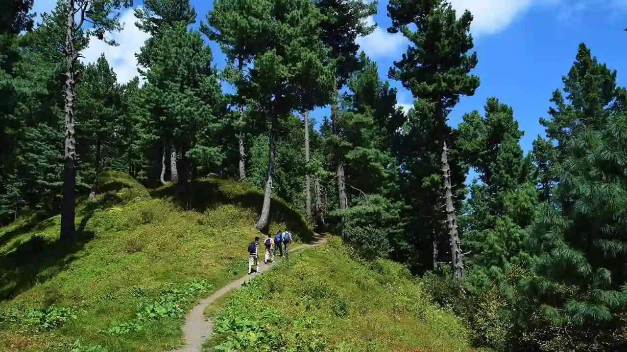
Hiking is not just an objective in healthcare. It also involves being entertained by nature's beauty and respecting wildlife. This has a basic and positive impact on successful hikers. The best hiking trail you can choose for an unforgettable experience is the Miranjanihikingtrack, which is on the north side of Pakistan. Miranjani Abbottabad isanabsolute beauty in all seasons.
Miranjani Top is a fantastic tourist attraction place which offers panoramic views throughout the year, and you can easily visit it in your free time. Let's have a look at the average Miranjani top weather in Murree.
| Season | Month | Temperature | Weather |
|---|---|---|---|
Winter |
Dec - Feb |
Average high 12.6°C (54.7°F) Average low 2.6°C (36.7°F) |
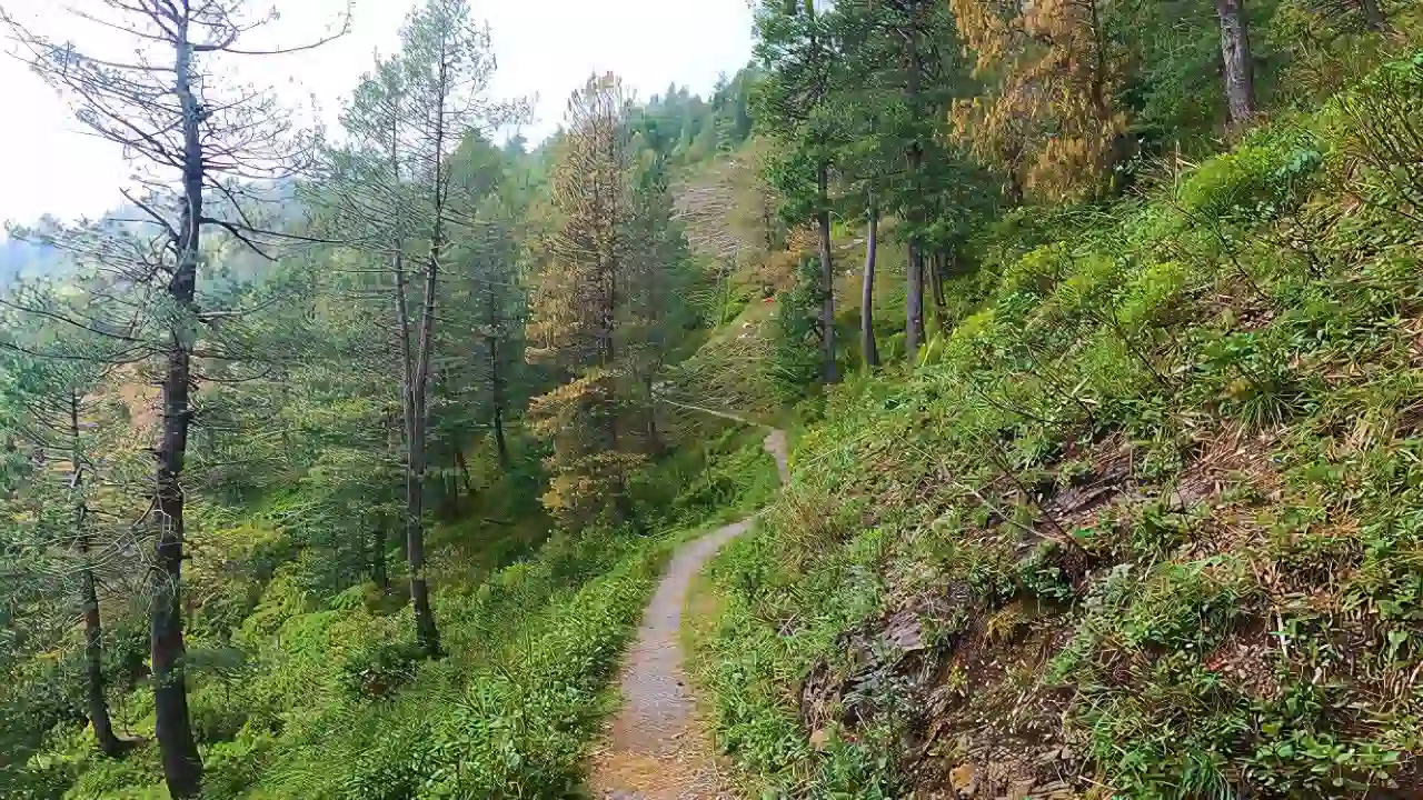
The coldest and freezing weather offers snow-enshrouded mountains |
Spring |
March - May |
Min 11.5°C (52.7°F) Max 24.2°C (75.6°F) |
Pleasant yet cool and refreshing, with the essence of natural beauty |
Summer |
June - Aug |
Between 31.5°C (88.7°F) and 20.5°C (68.9°F) |
Cool breeze with a hint of warmth in daytime, and cool nights |
Autumn |
Sep - Nov |
Average high 19.5°C (67.1°F) Average low 8.2°C (46.8°F) |
Beginning of a frost clock. |
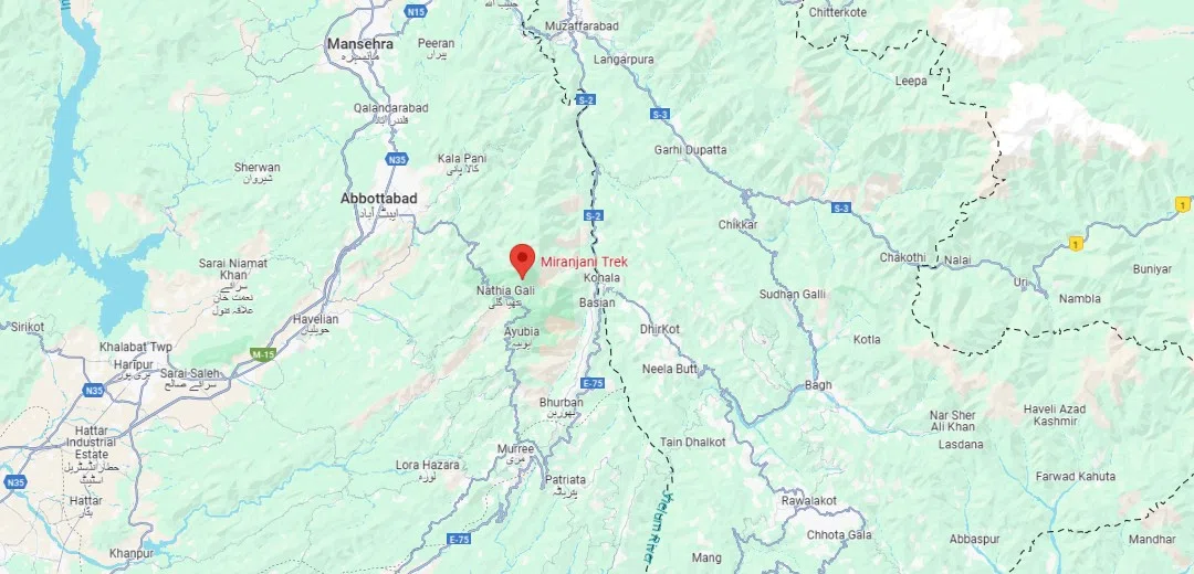
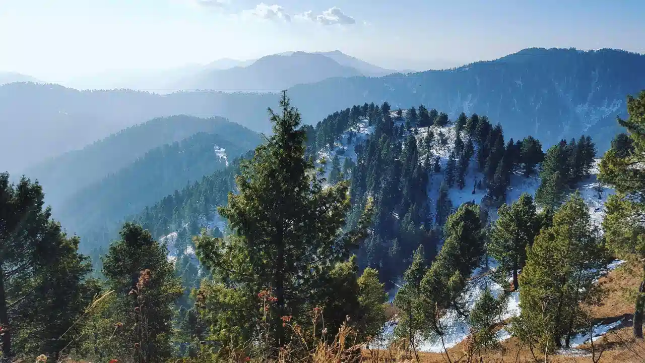
In Abbottabad district, Khyber Pakhtunkhwa, this outdoor green space will spellbind your soul with its charm and captivate your eyes. The Miranjani peak is a masterpiece of nature, based on sweeping mountains and a wide range of high trees is the highest point of the Gilyat Region, elevation of 2,992 metres. The Nathia Gali to Miranjani track is the nearest route to reach the Miranjani top.
A map is a guide to exploring the Miranjanitophike through the safest trail while admiring the scenic views and bird chirping.
Let's overlook the Miranjani top distance from different locations to see how much time it will take to reach. Also, which route will take us to Miranjani Abbottabad to witness the radiant complexions of nature? There you can avail a chance to spend a pleasant time with family, to click pictures for your scrapbook or travel diary.
Most of the travellers use the Murree Expressway from Islamabad to reach Murree. 90.5 km distance can be covered in 3 hours, but it can take more time if the snowfall happens or during rush hour.
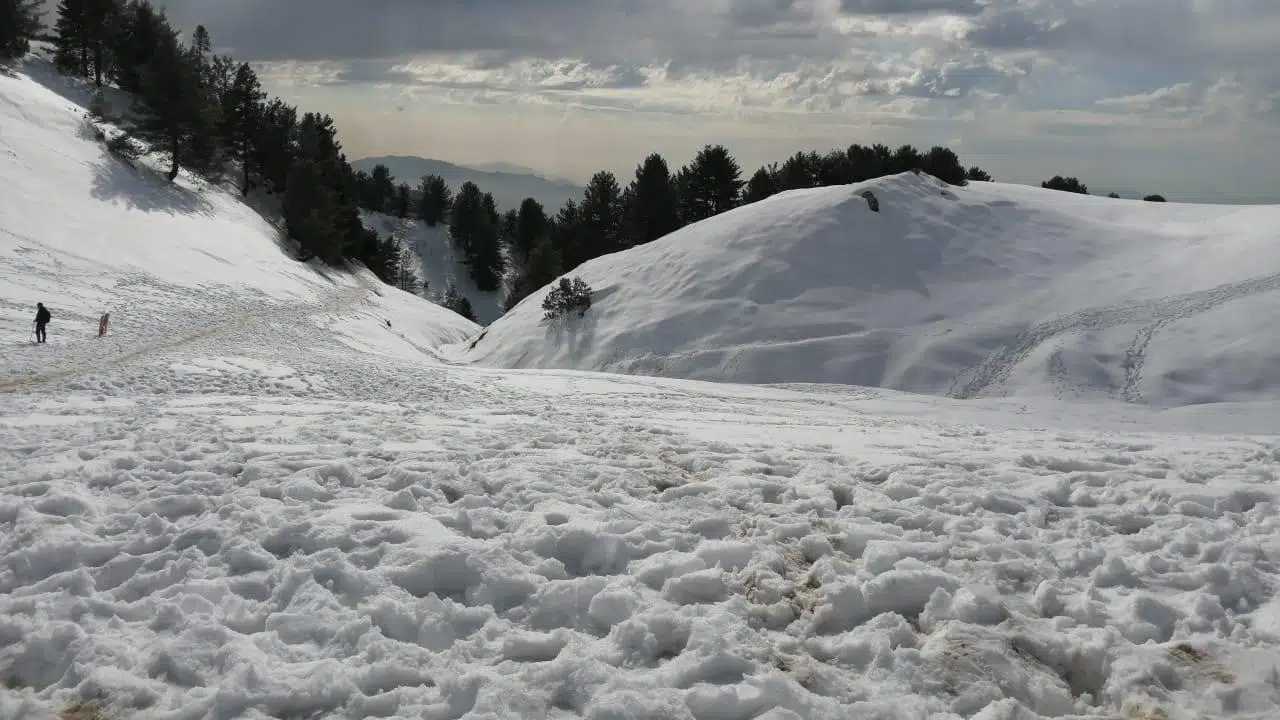
Dagri Bangla is the historical Bangla, which is not a specifically accommodating place, but it was in the British times. Now it's a place for picnics and camping to spend nights under the cloudy sky of Murree. Miranjani to Dagri Bangla takes a 2-hour drive via Nathiagalli road.
The Miranjani top track starts from Nathia Gali, and the distance from Nathia Gali to Miranjani takes a 12-minute drive through the Upper Nathia Gali road.
What characteristics make a place worth visiting? From the tourist's point of view, a place that offers a comfortable stay with modern style has a natural panoramic view, hiking treks, pleasant weather, safe picnic points, ground for kids, and is easily accessible by transportation.
Miranjani is an outstanding place, embracing all the qualities of the northern region. It is famous for its treks and picnic spots. Families usually visit on weekends or to spend vacations to escape from the summer heat. There are many restaurants and top-notch hotels for luxurious accommodation as well, and Fiora Hotel is one of them.
Nathia Gali is a hill station in Murree, the biggest attraction among tourists, especially during summer vacations and when snowfall occurs. This place is the nearest to the Miranjani trek. You can visit Nathia Gali to enjoy lush greenery and meadows, and historical buildings which were built by the British, such as the church, St. Matthew's
To reach Daghri Bangla, you have to cover the distance through hiking and trekking, which is considered moderate in difficulty. Dagri Bangla is a point where you can enjoy a picnic spot, camping, a bonfire, and a majestic night view from the top of the hill.
Miranjani trek is considered one of the moderate hiking tracks, but hiking trails always have some difficult and slippery points that level up the difficulty and adventurous experience. Miranjanitrekstartpoint is kp Governer house nathia gali . Experienced hikers complete this trekking route in a maximum of 3 and a half hours, but if you are not used to hiking, it will surely exhaust you and double the Miranjani top hiking time.
Miranjani is the highest peak of the Gilyat Region. From this point, you can enjoy fabulous scenic views of Gilyat and Murree. The 9,816-foot HeightofMiranjaniTop is paradise for hikers, and throughout the trek, you will witness unconditional grove enchantment and ecstatic forest. Miranjani Peak and Muhkpuri Top are both famous hiking trails in Murree, Abbottabad.
If we are discussing Miranjani's trekking spot, then we must have a precise look at Mushkpuri top.
Well, if you go for Mushkpuri track length, then it is two thousand eight hundred meters high point, which is known as Mushkpuri, situated in the north of the Khyber Pakhtunkhwa province, Abbottabad district, offers a breathtaking glimpse of the Kashmir mountains and the foreland view of the surrounding area. A smooth hiking track leads you to the Mushkpuri peak. Mushkpuri top track distance is approximately 4 km, which takes a maximum of 2 hours.

Hiking is a physical struggle that requires strength, stamina, and a firm grip to reach the top by passing the plateau. If we have to estimate the difficulty level of both hiking treks, then the calculations emphasise that Miranjani is more challenging. The reason is that the Mushkpuri track length is a smooth and easy route for those with no hiking experience; on the other hand, Miranjani is more challenging, especially at the endpoint.
Hotels represent the area and show the hospitality of their people. The top hotel that we suggest is The Fiora Hotel in Murree, which offers the best services, a dine-in-and-out facility, and heart-throbbing views from the balcony. They even had free parking and wifi for their visitors. For more suggestions, we recommend:
We are wrapping up our blog here. Now you all know that the north side’s weather and panoramic view always attract tourists and are an excellent way to increase people's income. Suppose you are considering having a trip to northern countries. In that case, we recommend that you visit the Murree side first in Pakistan, especially in the Gilyat Region, which has the best hiking treks, picnic spots, and wildlife parks, and we will surely provide you and your family with the best hosting services in The Fiora.
Dunga Gali pipeline trek is the easiest and smoothest hiking trek to enjoy the forest beauty and mountainous views.
While hiking, you walk on challenging paths and sweat. If you wear stiff jeans and an unstretchable dress, it may rip and give you a rash. So, take trekking suits for hiking.
The Miranjani trek is considered challenging compared to the Mushkpuri trek. But if we talk about a solo trek, it's a smooth trek with fluctuating land shape.
The first highest peak in Murree, Nathia Gali, is considered Miranjani Top, 9,816 ft high, and in the second position is Mushkpuri Top, with an elevation of 2,800 ft.
 +92 318 1818 189